
India's island choke point
The language of revenge makes for an arresting headline, but it obscures the more consequential story unfolding on Great Nicobar. India is not constructing a mechanism that can simply be activated to halt Chinese trade. It is attempting to convert a remote and sparsely developed island into a forward maritime hub from which it can observe strategic shipping routes, support naval and air operations and, in a serious crisis, make Chinese access to the Indian Ocean more difficult and expensive.
Great Nicobar is the southernmost large island in India’s Andaman and Nicobar archipelago. It lies closer to Indonesia than to the Indian mainland and sits near the approaches to the Strait of Malacca, one of the most important maritime passages in the world. The island is also approximately forty nautical miles from a heavily used east-west shipping corridor. That geography gives Great Nicobar a significance far greater than its size or population might suggest. Vessels travelling between the Indian Ocean, Southeast Asia and the South China Sea must pass through a limited number of navigable channels. The Strait of Malacca remains the principal commercial route because alternatives through the Sunda and Lombok straits generally require longer voyages, more fuel and additional time.
For China, whose economic strength depends heavily on seaborne exports, raw materials and imported energy, this is a persistent strategic vulnerability. For India, the same geography offers an opportunity to transform an isolated territory into an advanced observation, logistics and deterrence platform.
A nine-billion-dollar transformation
The Great Nicobar development programme is commonly described as an investment worth roughly nine billion dollars, although its estimated cost has changed as the plans have been revised. The wider programme is currently valued at approximately 81,000 crore rupees and covers around 166 square kilometres.
It combines four interconnected projects. The first is a deep-water international container transhipment port at Galathea Bay. The second is a new airport intended for both civilian and military use. The third is a gas and solar power complex with a planned capacity of 450 megavolt-amperes. The fourth is a new township with roads, water systems, communications, public services and industrial infrastructure.
The initial two phases of the proposed port were appraised in 2026 at a combined cost of 48,862 crore rupees. They are designed to provide twelve container berths and an annual handling capacity of 11.8 million twenty-foot equivalent units. Longer-term plans could expand the port still further. Natural water depths of between twenty and thirty metres are among Galathea Bay’s most important commercial advantages. They could allow the terminal to receive the largest modern container ships without the severe draught restrictions encountered at many existing Indian ports.
The new airport is equally significant. With an estimated investment of around 13,000 crore rupees, it is intended to accommodate civilian aircraft as well as military transports, maritime patrol aircraft and combat aircraft. Operational control is expected to rest with the Indian Navy, giving New Delhi a much larger aviation platform in the south-eastern Indian Ocean than is available at the existing airfield on the island.
The port, airport and power facilities therefore cannot be understood as separate construction schemes. Together, they are intended to create the permanent logistical foundation required for sustained economic and military activity.
India wants its cargo back
The commercial argument behind the project is substantial. India has historically routed a large share of its container transhipment traffic through foreign ports, particularly Colombo, Singapore and Port Klang. Containers arriving on large intercontinental vessels are frequently transferred at those hubs to smaller feeder ships serving Indian destinations.
That arrangement costs India revenue, creates dependence on infrastructure outside its jurisdiction and reduces its influence over regional shipping networks. A competitive deep-water terminal at Great Nicobar could intercept cargo moving between the Indian Ocean and East Asia while serving ports on India’s eastern coast, Bangladesh, Myanmar and other parts of Southeast Asia. The location is attractive, but geography alone does not create a successful port. Shipping companies choose terminals according to price, reliability, vessel turnaround times, customs efficiency, digital systems, frequency of feeder connections and the availability of repair, storage and bunkering services. Galathea Bay will have to compete not only with Singapore, Colombo and Port Klang but also with emerging Indian facilities such as Vizhinjam.
The financial structure reveals how difficult that competition may be. The first two port phases have been designed as a public-private partnership, with Indian-controlled ownership and a proposed concession period of fifty years. Project planners sought viability-gap assistance of 12,230 crore rupees to reduce the risk for private investors. Financial appraisers concluded that the requested support did not fit the standard viability-gap funding framework. The ports ministry may therefore have to provide capital assistance from its own budget or seek a separate political decision. This is a crucial detail. It suggests that Great Nicobar’s strategic value may justify public expenditure that would be difficult to defend on commercial returns alone.
In other words, the port is not merely a business venture. It is strategic infrastructure with a commercial component.
What the island changes for China
The most immediate military benefit would be improved maritime domain awareness. Radar installations, long-range aircraft, drones, naval vessels and intelligence systems based closer to the Malacca approaches would give India a clearer picture of movements between the western Pacific and the Indian Ocean. Chinese naval deployments in the Indian Ocean have become more regular over the past two decades. Warships assigned to anti-piracy patrols, survey vessels, submarines and support ships have all demonstrated Beijing’s growing ability to operate far from the Chinese coastline. Access to ports developed or operated by Chinese companies has also increased Beijing’s logistical options across the region.
A fully equipped Great Nicobar hub would allow India to monitor those movements from a much more advantageous position. It could support patrol aircraft for longer periods, shorten response times and provide fuel, maintenance and communications closer to the principal maritime routes. This does not mean that India could effortlessly close the Strait of Malacca. The expression “choking Beijing” is strategically evocative but operationally misleading. The strait is bordered by Malaysia, Indonesia and Singapore. India does not control it, and any attempt to block commercial shipping would constitute an extraordinary act with global economic and military consequences. Maintaining an effective blockade against a major power would require persistent naval and air superiority, extensive intelligence, secure logistics and cooperation from other states.
Great Nicobar is therefore not a switch with which India can turn off Chinese trade. Its importance lies in deterrence and strategic uncertainty. It could increase the number of assets China would need to protect its sea lanes, make covert naval movement more difficult and force Beijing to devote greater attention to the eastern Indian Ocean.
Alternative Chinese routes do exist. Ships can use the Sunda or Lombok straits, while pipelines through Myanmar and overland corridors through Pakistan provide limited diversification. None of them can easily replace the scale, efficiency and established commercial networks associated with the Malacca route. India does not need the ability to stop every Chinese vessel to gain leverage. It needs the credible capacity to observe movements, complicate operations and impose additional costs during a confrontation.
A forward base must also survive
Building runways, quays and radar stations is only the beginning. A remote installation becomes strategically valuable only when it can continue operating under pressure.
Great Nicobar will require secure fuel storage, ammunition facilities, maintenance depots, air-defence systems, hardened aircraft shelters, redundant communications and dependable supply links. It must also be protected against submarine activity, missile attacks, cyber disruption and sabotage. The island’s distance from India’s main industrial and military centres creates a logistical challenge. Personnel, spare parts, construction materials and emergency supplies must travel long distances by sea or air. Severe weather can interrupt those connections, while the narrow local infrastructure base leaves little room for failure.
A highly visible airport and port without adequate protection could become targets rather than instruments of leverage. The strategic value of Great Nicobar will consequently depend less on ceremonial inaugurations than on the unglamorous systems that keep aircraft flying, ships supplied and sensors functioning during a crisis.
The project could also assist India in humanitarian relief and disaster response. A major airport, deep-water port and permanent logistics network would provide a forward base for operations after cyclones, earthquakes or tsunamis across Southeast Asia. Such capabilities would strengthen India’s claim to be a dependable regional security partner rather than merely a country seeking military advantage over China.
The ecological price cannot be hidden
Great Nicobar is not an empty piece of territory. It contains tropical rainforest, mangroves, coral habitats and numerous endemic species. Galathea Bay is associated with the nesting grounds of giant leatherback turtles, while the island is also home to the Nicobar megapode, saltwater crocodiles and other vulnerable wildlife. The project involves the diversion of approximately 130.75 square kilometres of forest land. Estimates indicate that close to one million trees could eventually be affected, although the government maintains that significant green areas will remain within the wider development zone.
Authorities have imposed dozens of environmental conditions and planned compensatory afforestation covering more than ninety-seven square kilometres. The government also argues that the large majority of Great Nicobar will remain within forests, national parks, protected areas, a biosphere reserve and tribal conservation zones. The National Green Tribunal declined to stop the development in February 2026, concluding that there was no sufficient basis for overturning the existing environmental and coastal clearances. It nevertheless required strict compliance with the protective conditions.
The ruling did not eliminate the underlying concerns. An island rainforest is a complex and isolated ecosystem that cannot simply be recreated through tree planting elsewhere. Forest loss can alter freshwater systems, coastal stability and wildlife migration even when a large percentage of the island formally remains protected.
There is also a profound human dimension. Great Nicobar is home to the Nicobarese and the Shompen, one of the world’s most isolated indigenous communities. The government says the project will not physically displace them and has promised dedicated safeguards. The greater danger may arise from indirect contact. A large influx of construction workers, officials, traders and future residents could expose isolated communities to disease, cultural disruption and pressure on traditional territory. Preventing direct displacement will not be sufficient if the surrounding social and ecological conditions are transformed beyond recognition.
A landscape shaped by disaster
The island lies in a seismically active region. The Indian Ocean tsunami of 2004 devastated Great Nicobar, destroyed settlements and caused severe land subsidence at its southern end. Any new airport, port, power plant and township must therefore be designed for conditions far more demanding than those facing ordinary mainland infrastructure. Breakwaters, evacuation routes, emergency power systems, elevated storage, earthquake-resistant construction and redundant communications will all be essential. The financial cost of such resilience is high, but ignoring it would expose the entire programme to catastrophic failure.
Environmental protection and disaster planning are not secondary obstacles to the strategic project. They are part of its strategic credibility. A port delayed by legal challenges, damaged by a natural disaster or surrounded by social conflict would weaken rather than strengthen India’s position.
The project is not yet a finished weapon
The most important distinction is between ambition and operational reality. Great Nicobar is not currently capable of controlling the Malacca approaches on the scale suggested by dramatic descriptions of the project. In March 2026, the relevant public-private partnership committee recommended the first two port phases for further administrative consideration, subject to financial, contractual and ownership conditions. The airport had entered initial tendering, while the power plant and township remained at different stages of appraisal and approval.
The latest public timetable indicates that physical work on the Galathea Bay port is expected to begin in 2028. That schedule is later than earlier expectations that an initial port phase might already be operating by that year. Even after construction begins, completing the full island transformation will require many years and potentially several decades. Financing, private-sector participation, environmental monitoring, supply-chain constraints and construction in a remote seismic location could all affect the schedule. Cost escalation is also likely to remain a concern as designs become more detailed.
China will not stand still during that period. Beijing can strengthen alternative routes, expand naval deployments, increase cooperation with regional ports and develop capabilities intended to threaten Indian installations. Great Nicobar is therefore part of a continuing strategic competition rather than a final answer to it.
India’s real revenge is strategic patience
Describing the Great Nicobar project as India’s revenge on China captures the emotional appeal of a country turning geography against its principal Asian rival. Yet revenge is not the most accurate description. The project is better understood as an attempt to correct a long-standing imbalance. India possesses an island chain overlooking some of the world’s busiest sea routes, but for decades much of that geographical advantage remained underdeveloped. Great Nicobar represents an effort to convert position into capability.
Success will not be measured by whether India can literally stop Chinese shipping. It will be measured by whether the island gives New Delhi reliable surveillance, faster military response, commercially viable port operations and a resilient logistics network without inflicting irreversible damage on the people and ecosystems already there.
If those conditions are met, Great Nicobar could become one of India’s most consequential strategic investments. It would not choke Beijing in peacetime, but it could make China’s leaders think more carefully about the risks of confrontation in the Indian Ocean. That additional calculation is the true source of India’s leverage.

ATTENTION, ATENCIÓN, УВАГА, ВНИМАНИЕ, 注意事项, DİKKAT, 주의, ATENÇÃO

UNESCO accepts the US back into the fold after a five-year absence

This is how the Russian scum in Ukraine ends!

Video, ビデオ, 视频, Відео, 비디오, Wideo, 動画, Βίντεο, Видео!!
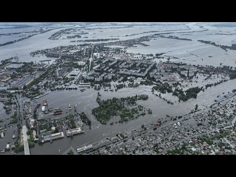
Ukraine's struggle: Surviving after the flood

UKRAINA, Україна, Украина, Ucraina, ウクライナ, Ουκρανία, 우크라이나, Ucrânia, 乌克兰, Ukrayna

Ukraine: War terror of the russian army!

War crime by the Russians: Thousands without drinking water in Ukraine

We thank the Heroes of Ukraine!

Arab League reinstates Syrian membership after a 12-years

Turkey's President Erdogan shows he is ready for a fight